Written by Dr. Arthur Mariano and Laura Bracken
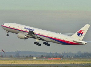 The Mayalsian Airlines plane that went missing on March 8, 2014 highlights the difficultly in finding objects drifting on the surface of the ocean. The difficulty in finding objects or people lost at sea is due to rough weather, wave breaking, sun glare, observer fatigue, and that the search regions are large. Small errors in the initial position of the object can quickly because large errors because the ocean is turbulent. After 1-2 weeks, the predicted location of the object can be off by miles. This growth of error is also true for the inverse problem of trying to determine where an object was at an earlier time.
The Consortium for Advanced Research on the Transport of Hydrocarbon in the Environment (CARTHE), funded by the BP/Gulf of Mexico Research Initiative, studies and performs numerical simulations of how objects move on the surface of the ocean due to wind, waves, and ocean currents. Their research is focused on oil movement but their methods are applicable to a large number of problems including search and rescue, dispersion of pollutants, the transport of fish larvae from a spawning site, and finding the source of a pollutant.
As a timely example of the application of the methods to real world problems, Professor Arthur J. Mariano, Edward H. Ryan, and Lucas C. Laurindo analyzed a satellite image published by the BBC on March 26th for a region centered at 90.5 E, -44.7 S. The mathematical problem they are working on is known as the inverse Lagrangian Prediction Problem or the source estimation problem. Given a location of an object at some time, information about ocean currents and winds, and knowledge of the data error, estimate where the object was at an earlier time. For example, if fish larvae are found at one location and they are two weeks old, where is the spawning location? If a pollutant or wreckage is found on the ocean surface, where did it come from?
It is assumed for the calculations that there is a field of debris in a region the size of a couple football fields on March 23rd. The simulations use information about the wind speeds, ocean currents, and uncertainty in those data sets to calculate where the debris was the previous two weeks given the location of debris on March 23rd.
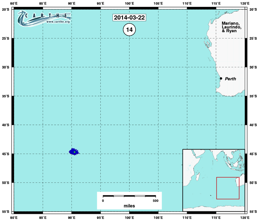
A set of plots for the estimated debris locations are shown for March 8th, March 15th, and March 22rd (below). As you go further back in time, the size of the cloud of possible locations increases because the uncertainty increases. These calculations demonstrate the difficulty in backtracking debris location given the amount of data uncertainty and the strong winds and currents in this region. Starting with a debris field that is in a region of 0.001 square miles, the search region grows to a large region approximately 10,000 square miles on Match 8th. Also, there are a few anomalous locations that are away from the highest concentrations of predicted search locations that have low probability but they are still possible locations.
As this example shows, the search region grows by seven orders of magnitude in 15 days. The search regions would continue to grow for longer prediction times, and it becomes more and more challenging to predict the movement of debris as time goes on. The Indian Ocean has large waves, strong winds and currents that move any set of objects drifting on the ocean surface in many different directions.
Calculation of where the debris could have been on March 22, 2014, one day before the satellite image-based location.
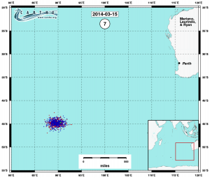
Calculation of where the debris could have been on March 15, 2014, one week before the satellite image-based location.
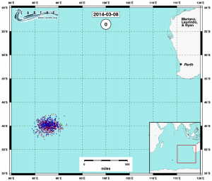
Calculation of where the debris could have been on March 8, 2014, 15 days before the satellite image-based location.